OpenTrailStash is a global webmap designed for exploring new places by bicycle, especially off-pavement. It uses data from OpenStreetMap, Natural Earth, Overture, and Mapzen Terrarium and is powered by MapLibre.
View Map View Source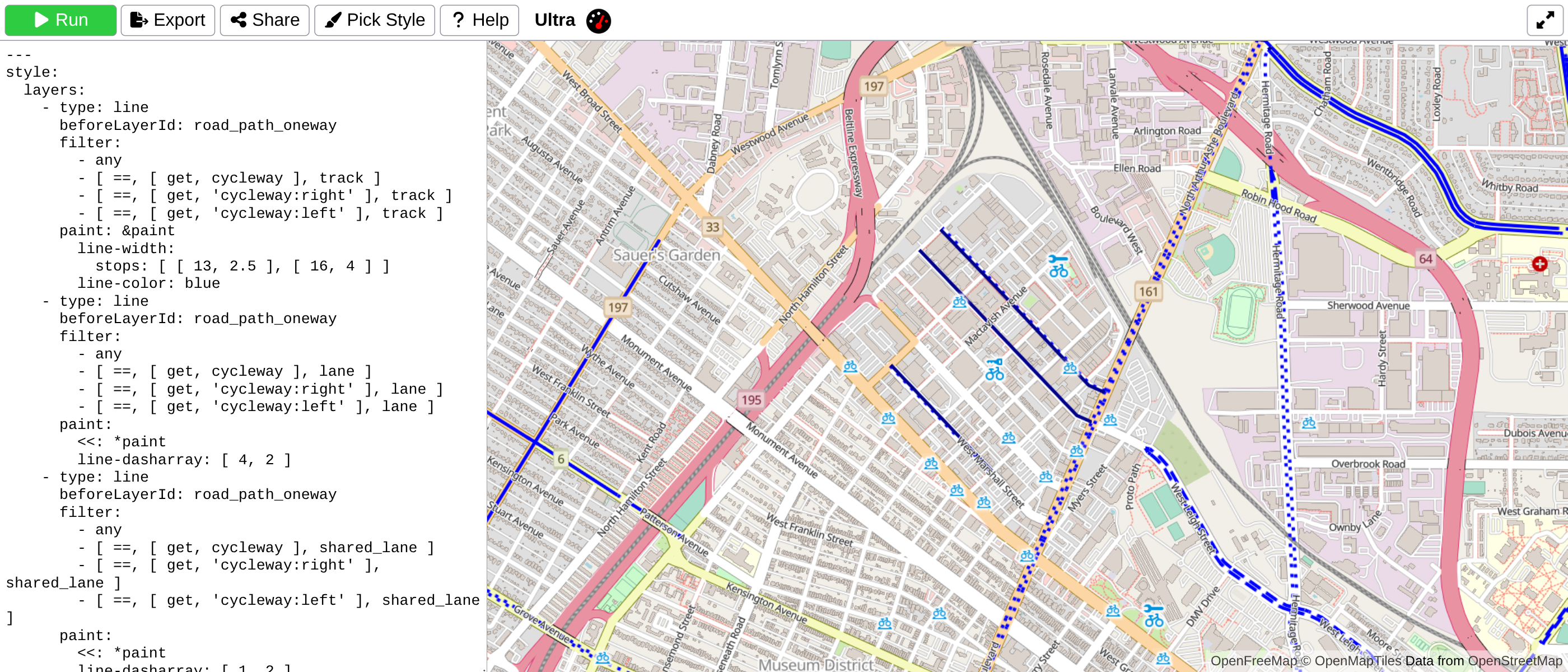
Ultra is a web based tool for making MapLibre GL maps with data from sources such as Overpass, GeoJSON, GPX, KML, TCX, and more.
View App View Source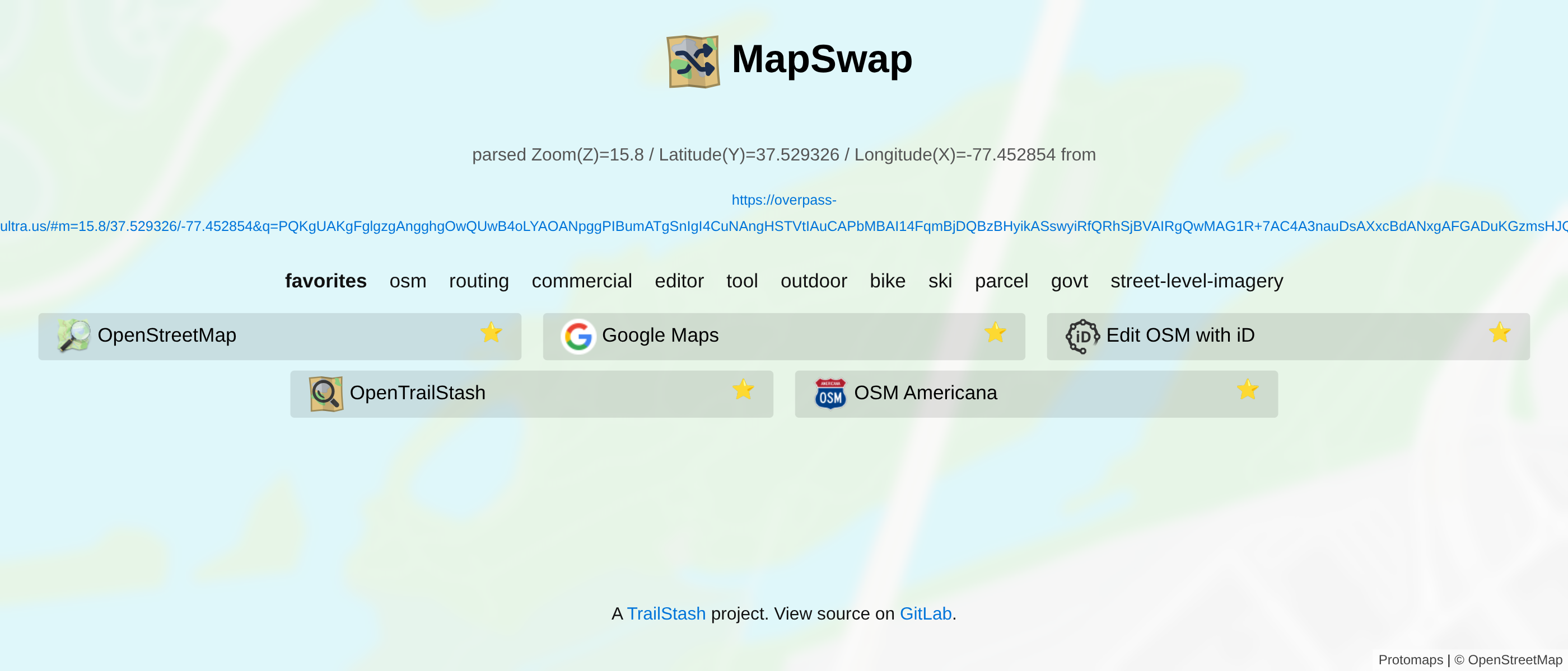
MapSwap is a utility for swapping between various map while preserving your viewport.
View App View Source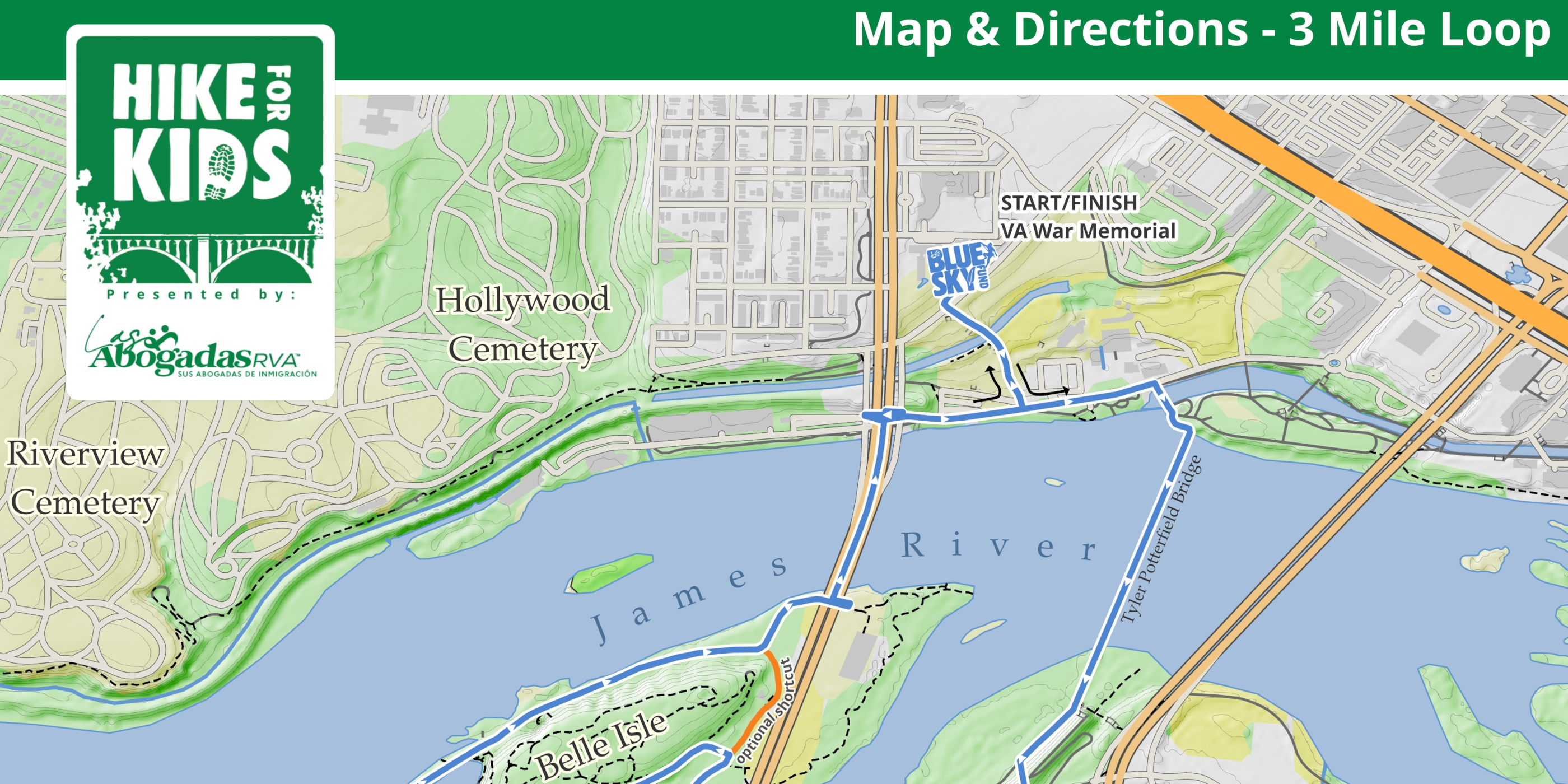
A map for Blue Sky Fund's annual fundraising event. Created in QGIS with roads, trails, buildings, and water from OpenStreetmap; Landcover from Overture; and contourlines&hillshade created from Mapzen Terrarium.
View 3mi Map View 7mi Map View 14mi Map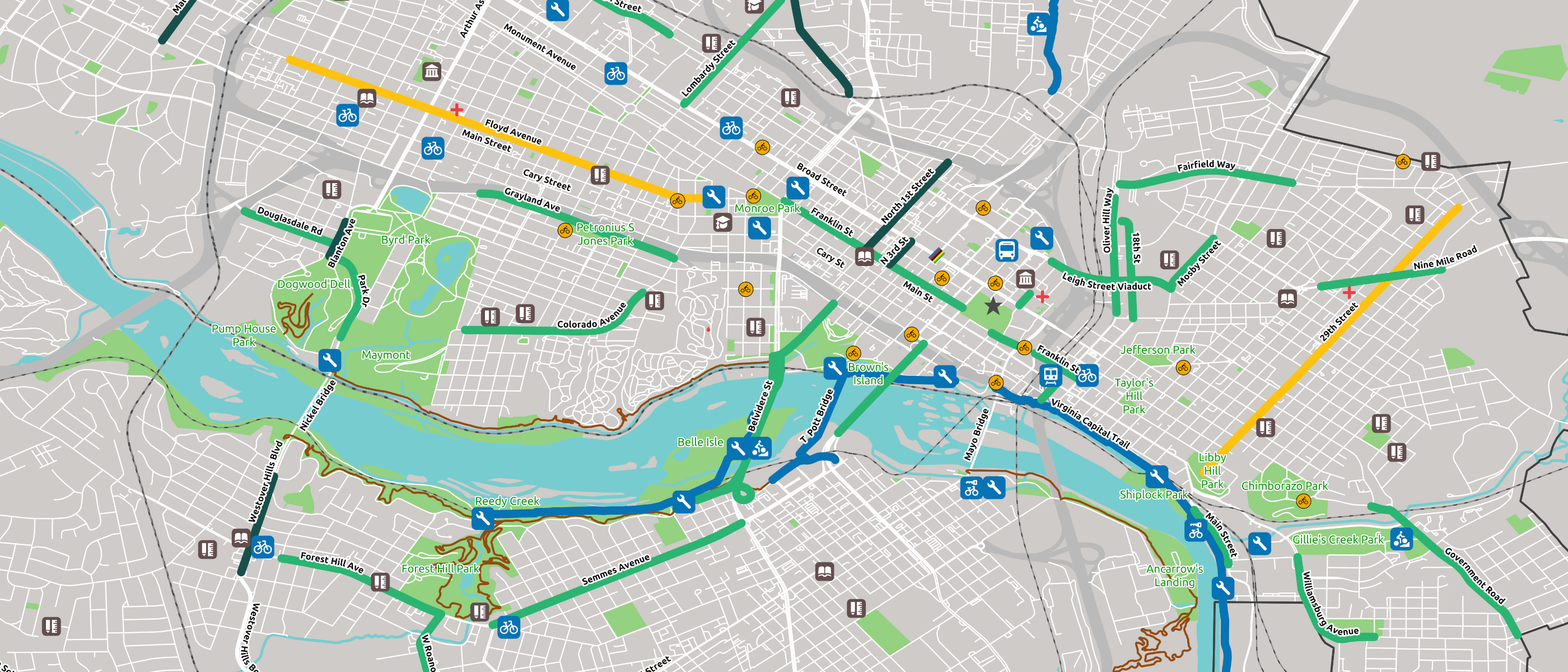
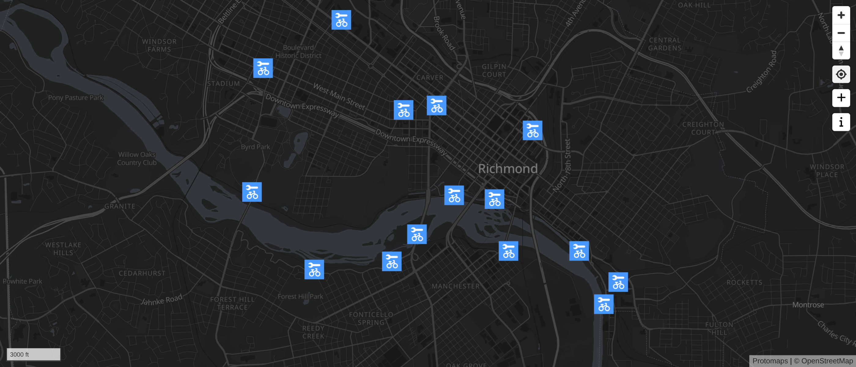
A map of Richmond, Virginia's bike infrastructure created for BikeWalkRVA. Created using QGIS and OpenStreetMap data.
View Map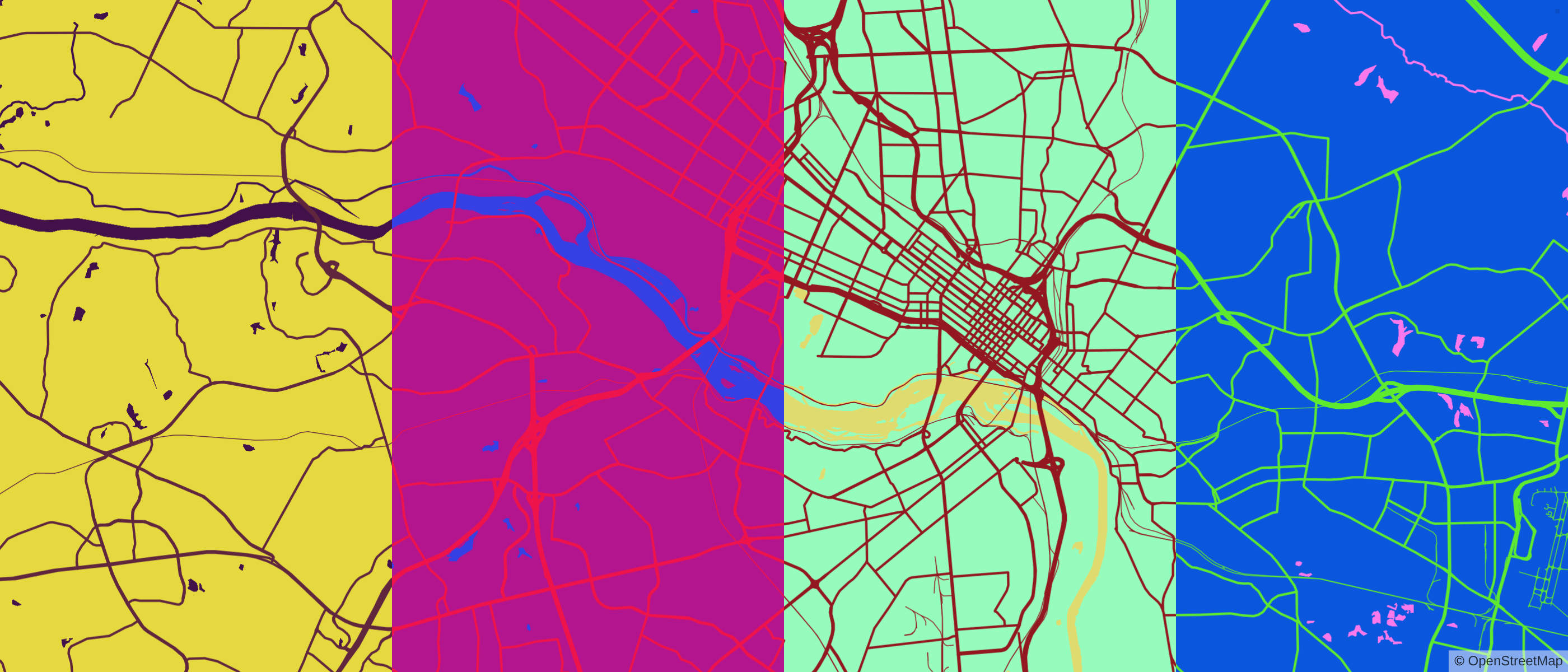
A web app for making simple maps from a color palette. Powered by MapLibre & Protomaps.
View app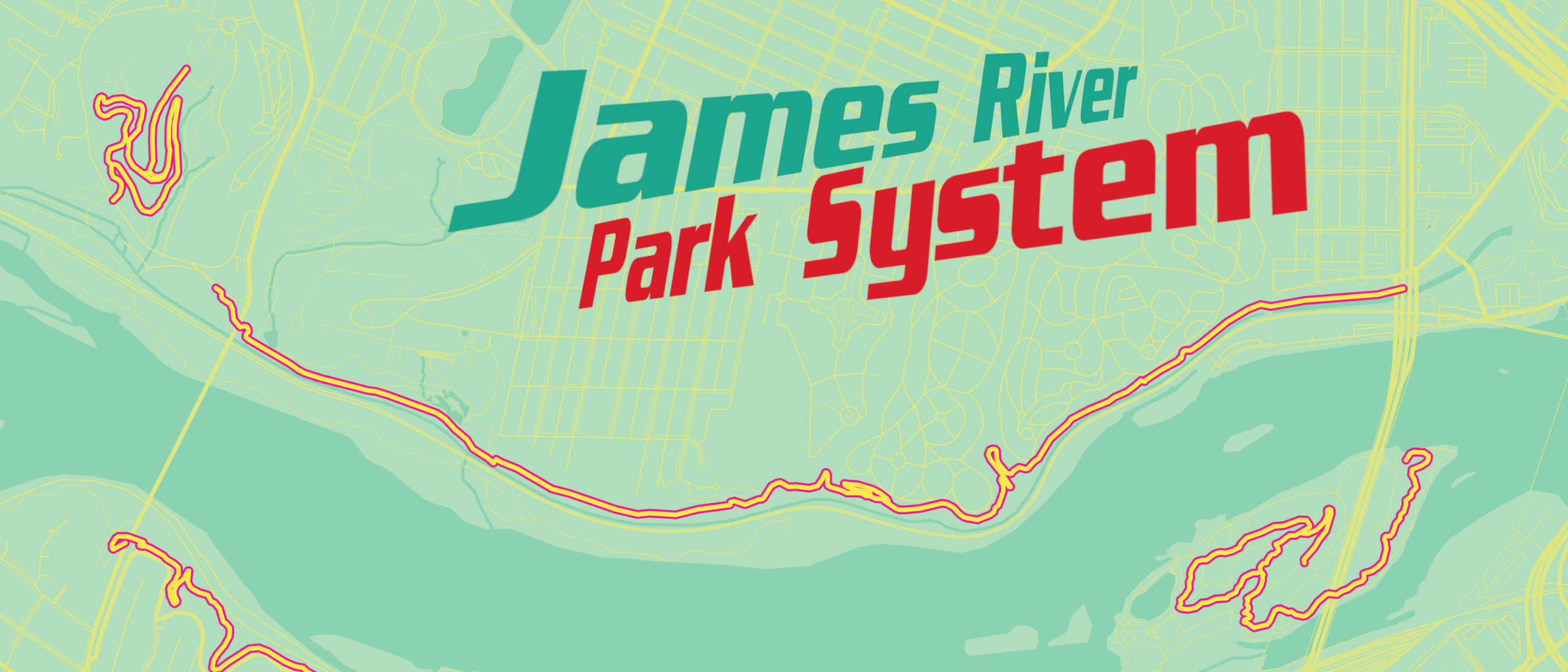
Part of signing up for MountainCat100 is to create a valentine for the James River Park System Trail crew. This map was my valentine for 2025, inspired by mtncat's Mountain Dew Baja Blast theme for the year. Created using Palette Map and Gimp.
View Map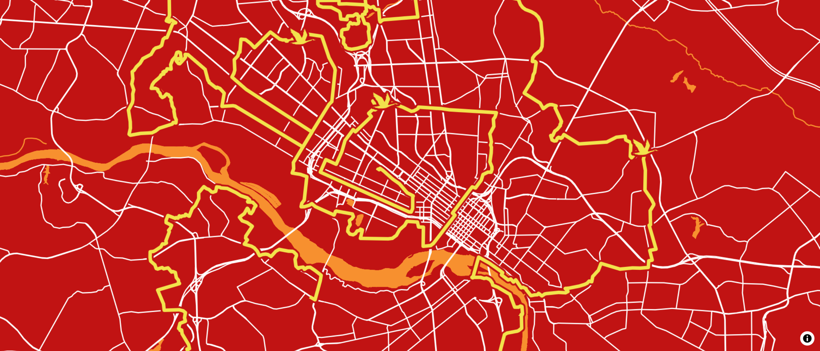
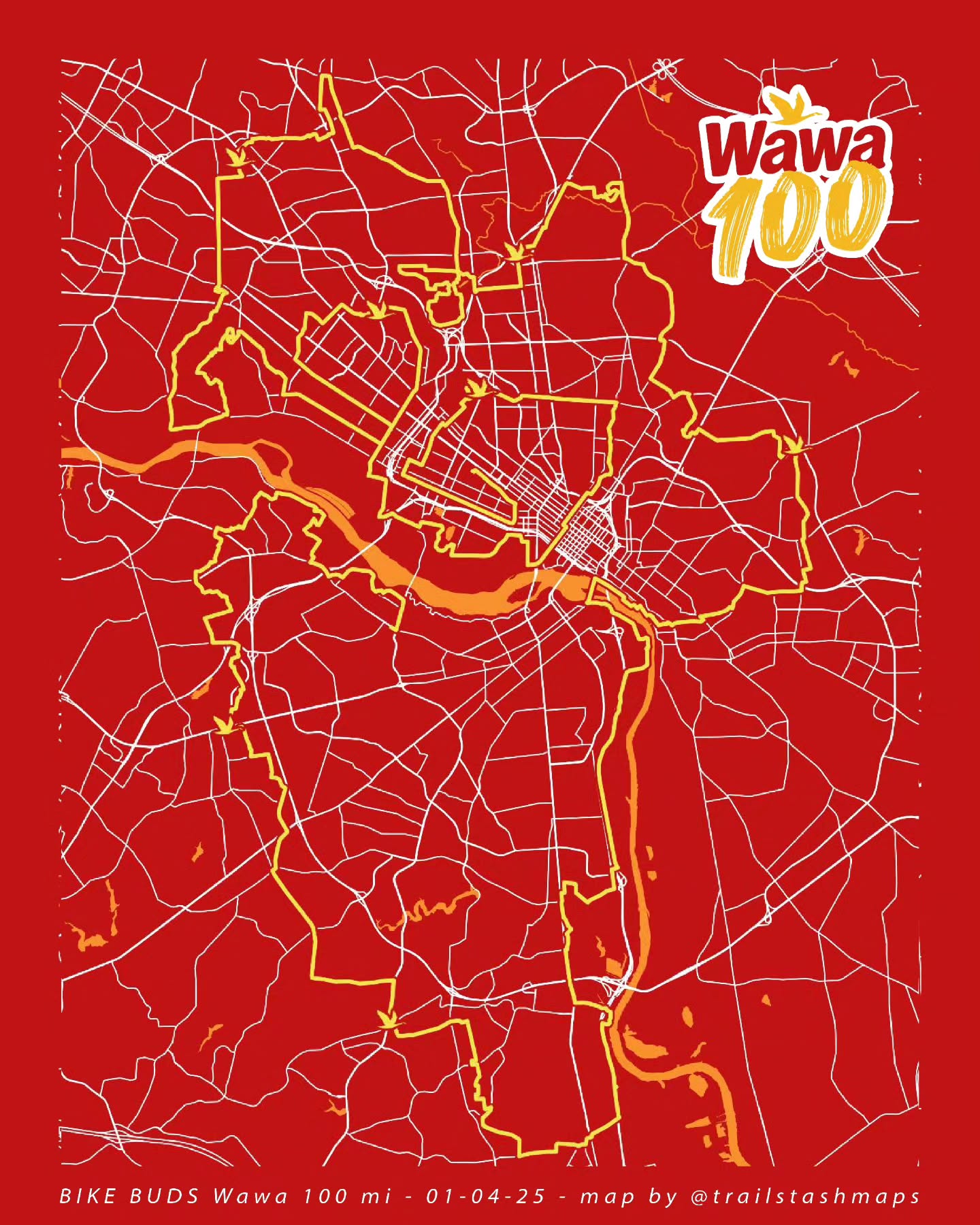
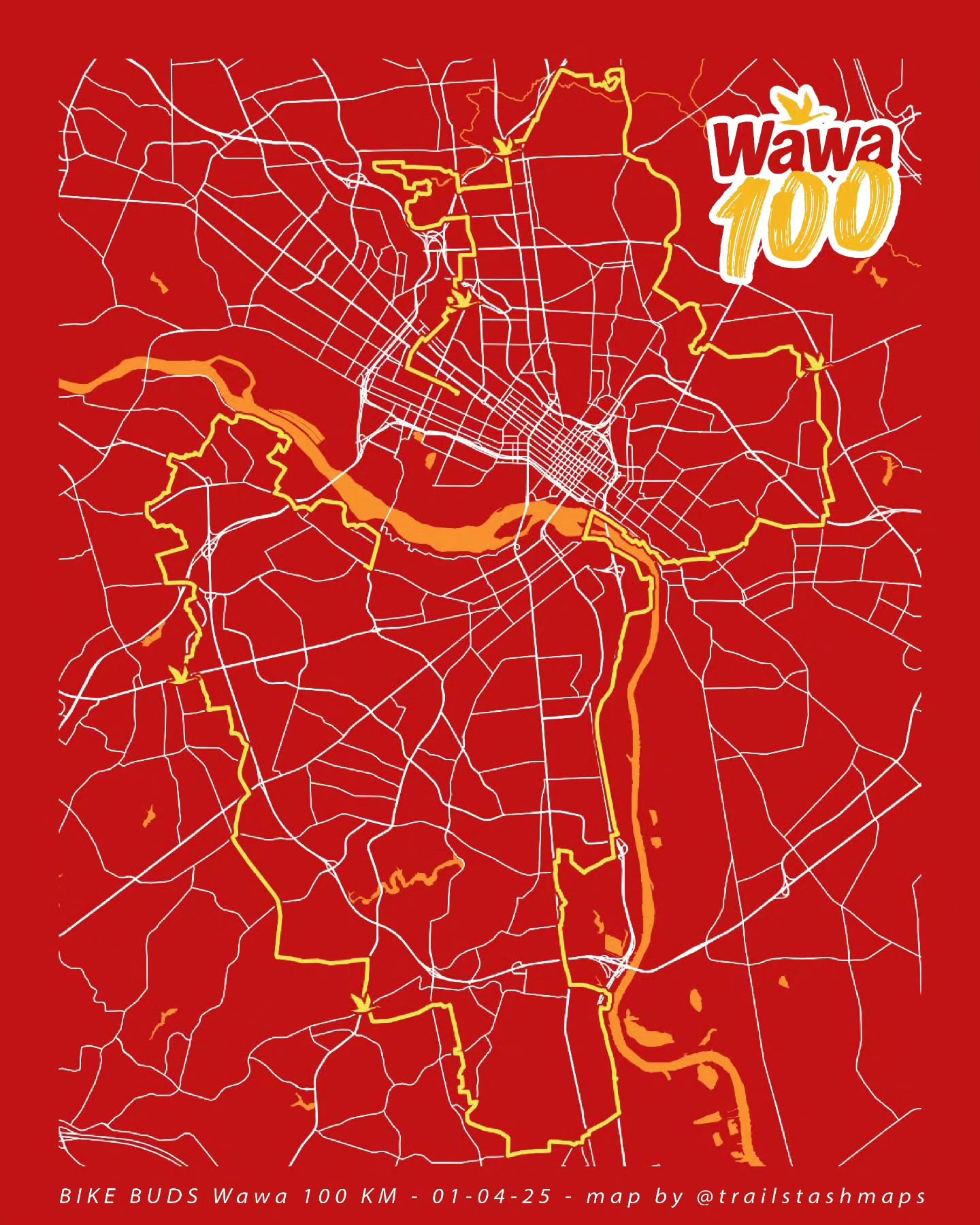
Maps ceated for BikeBuds' Wawa 100 ride. Created using Ultra.
View 100mi Map View 100km Map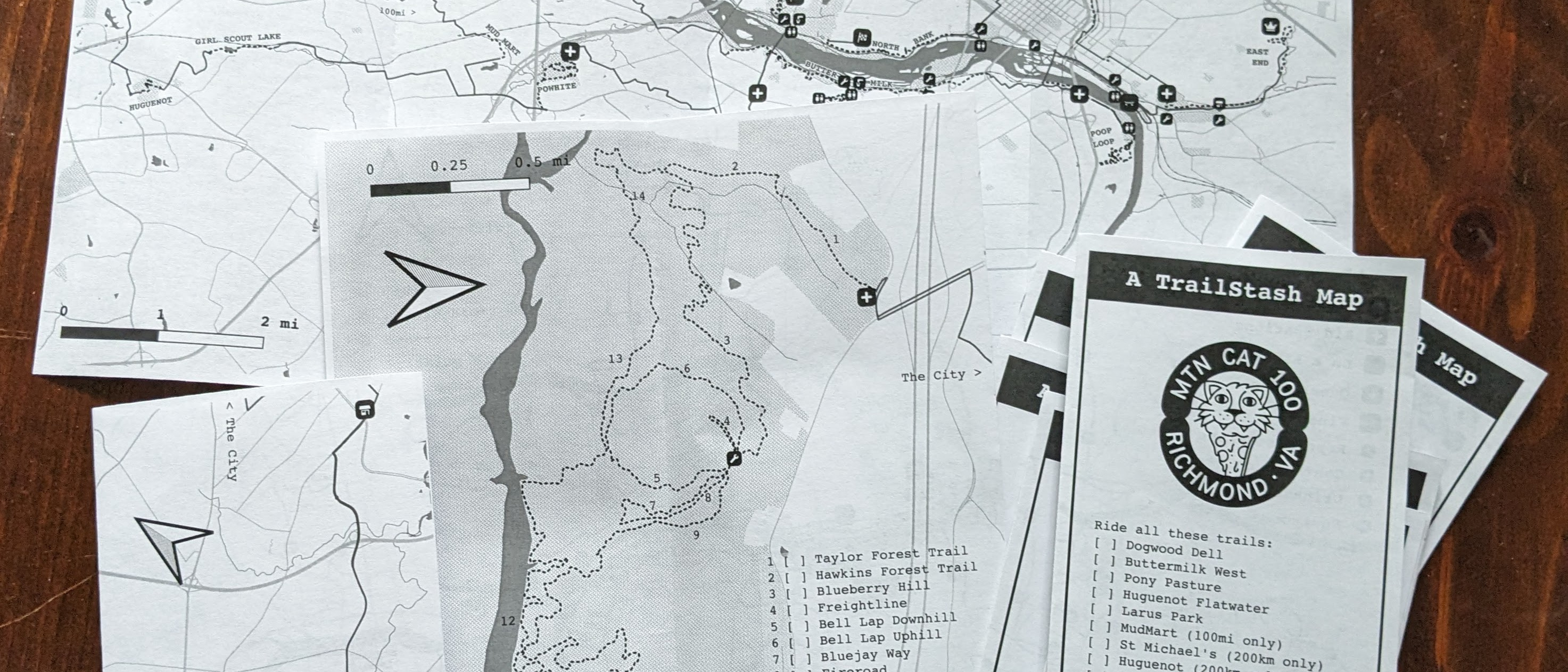
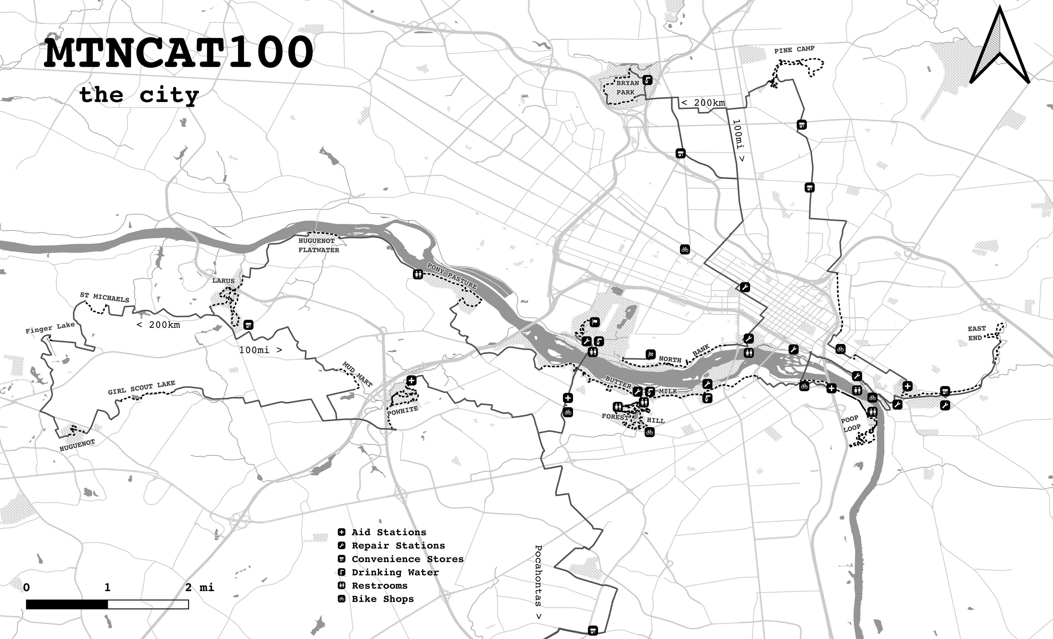
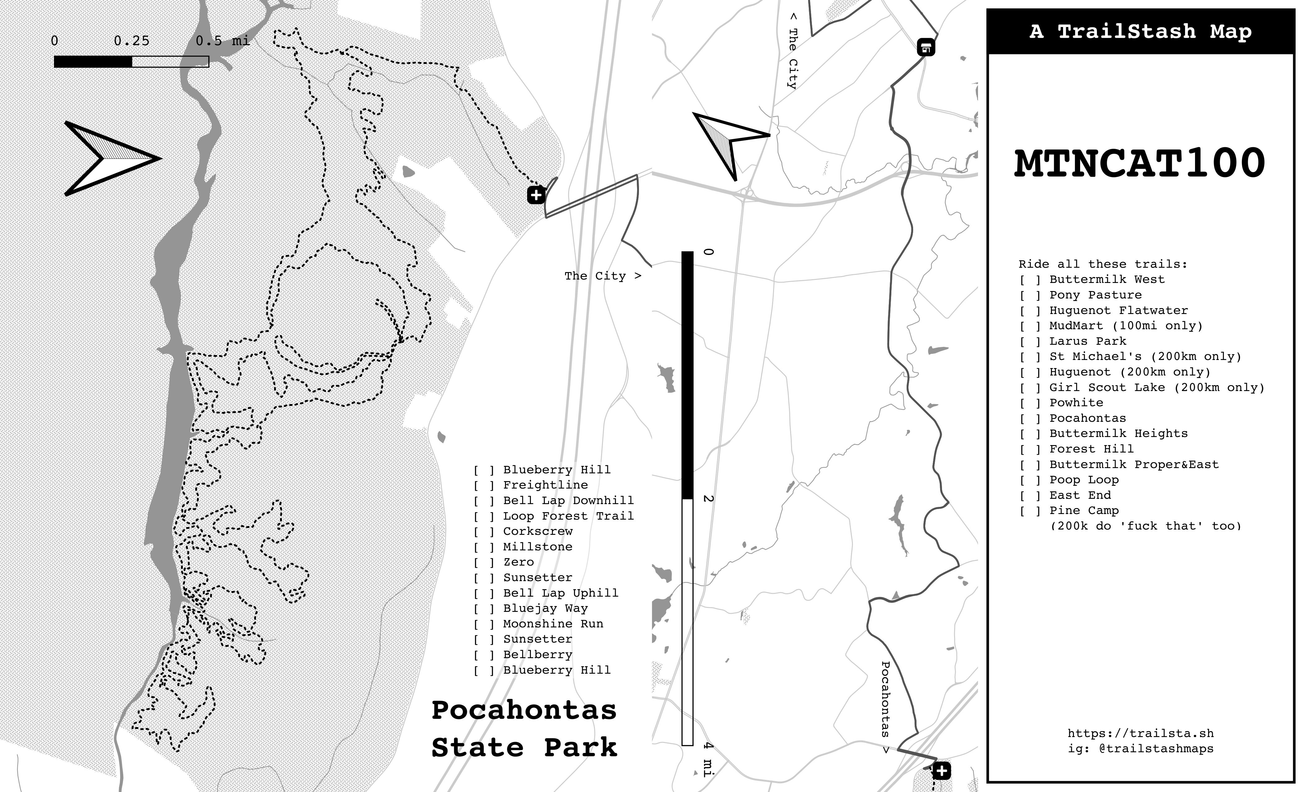
A map created for MoutainCat100. Created using QGIS.
View Main Map View Back Maps and Cover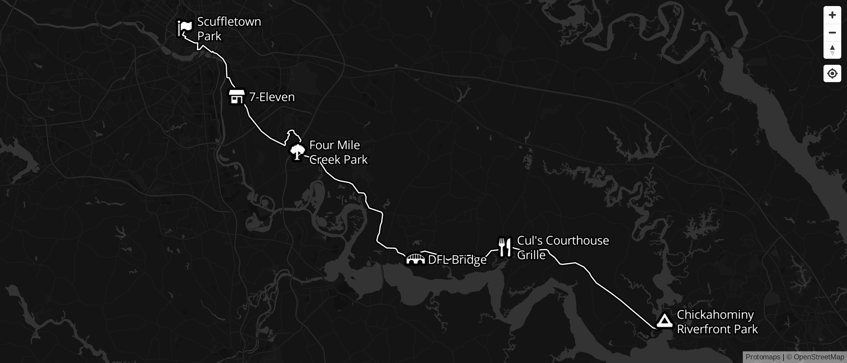
mordor.bike is a map made for DFL's annual camping trip. Powered by MapLibre & Protomaps.
View Map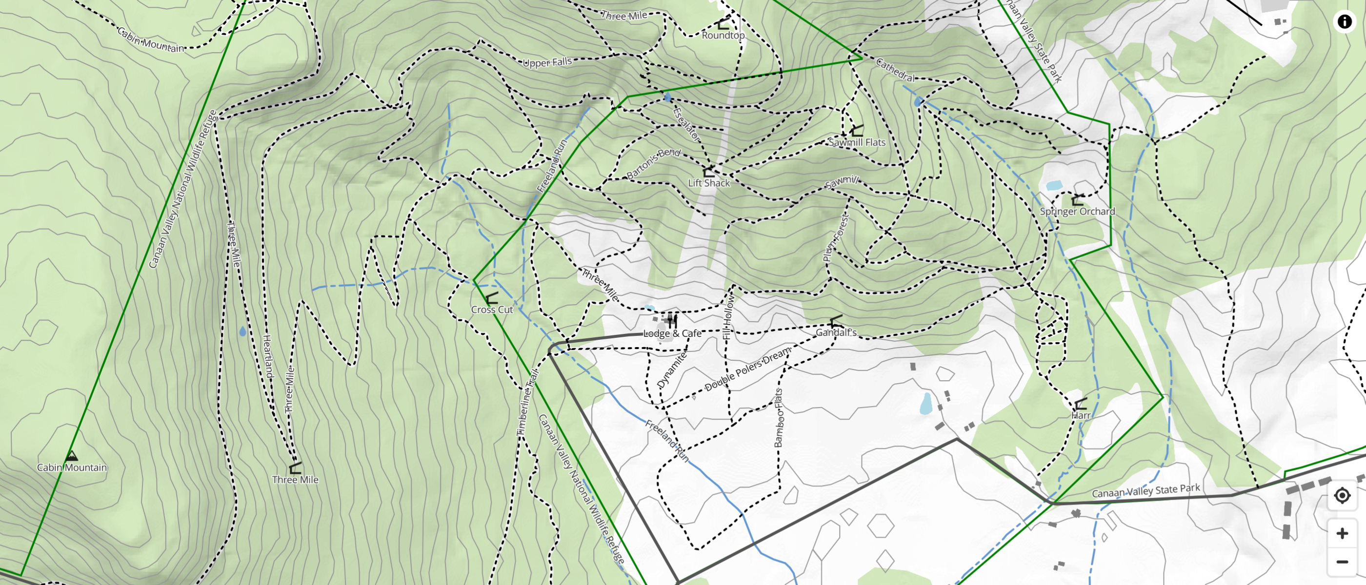
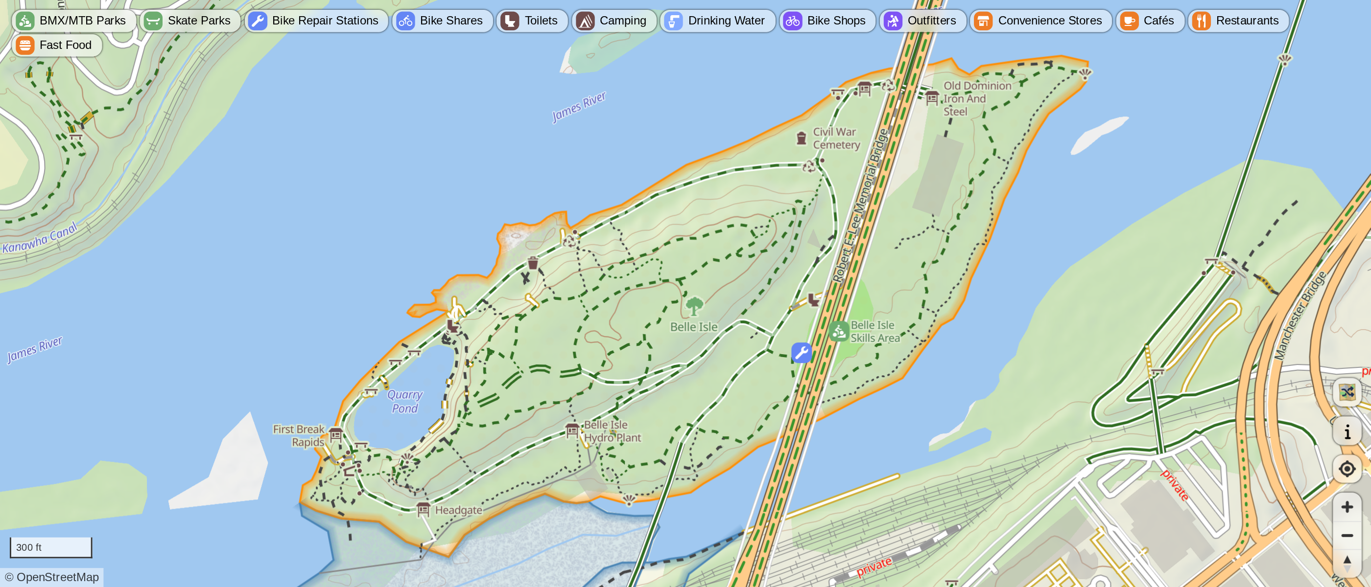
A webmap for finding bicycle repair stations. Powered by OpenStreetMap, Overpass, and Protomaps.
View Map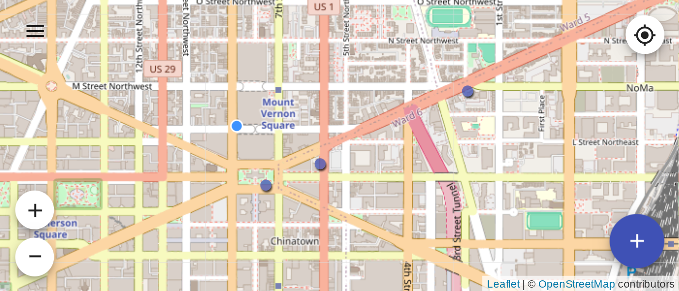
A webapp for quickly marking points on a map based on your current location. Powered by Leaflet.
View App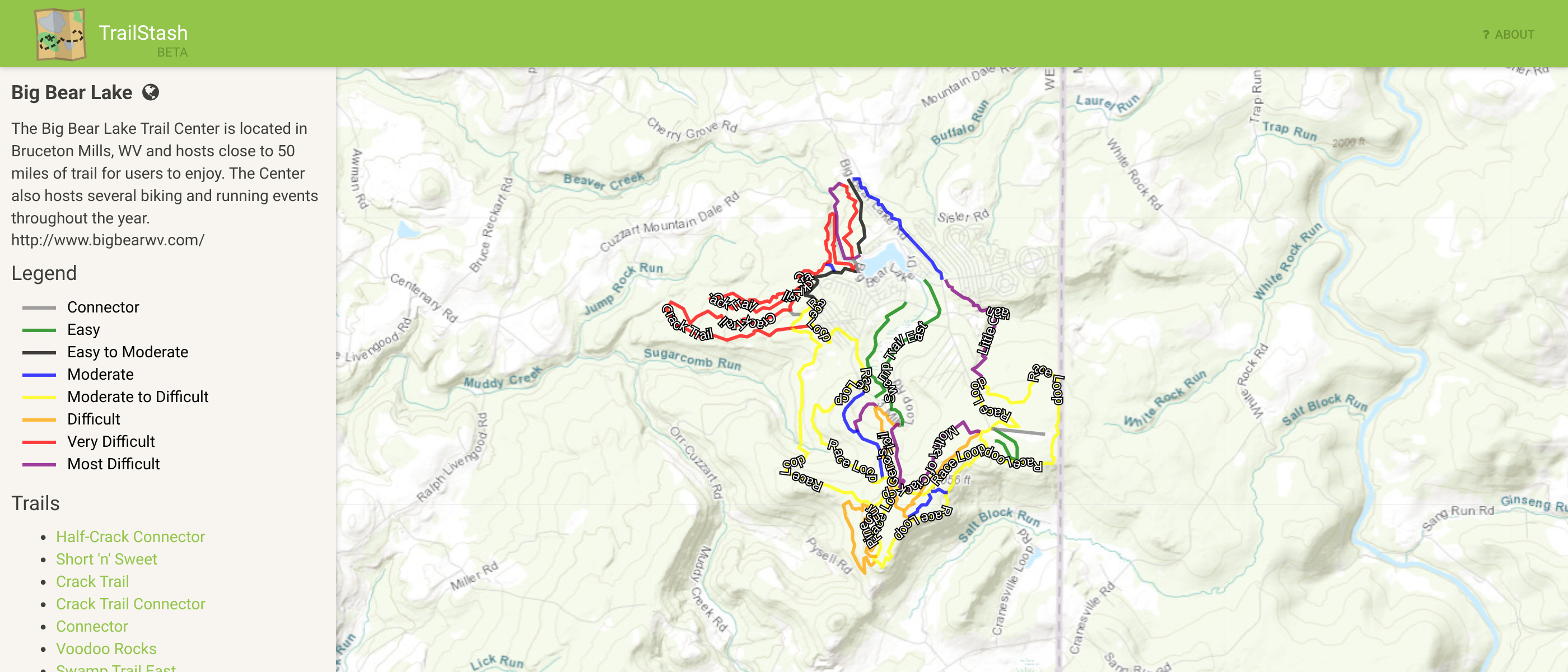
Where it all started. A map making platform powed by Leaflet and GeoDjango.
View archived maps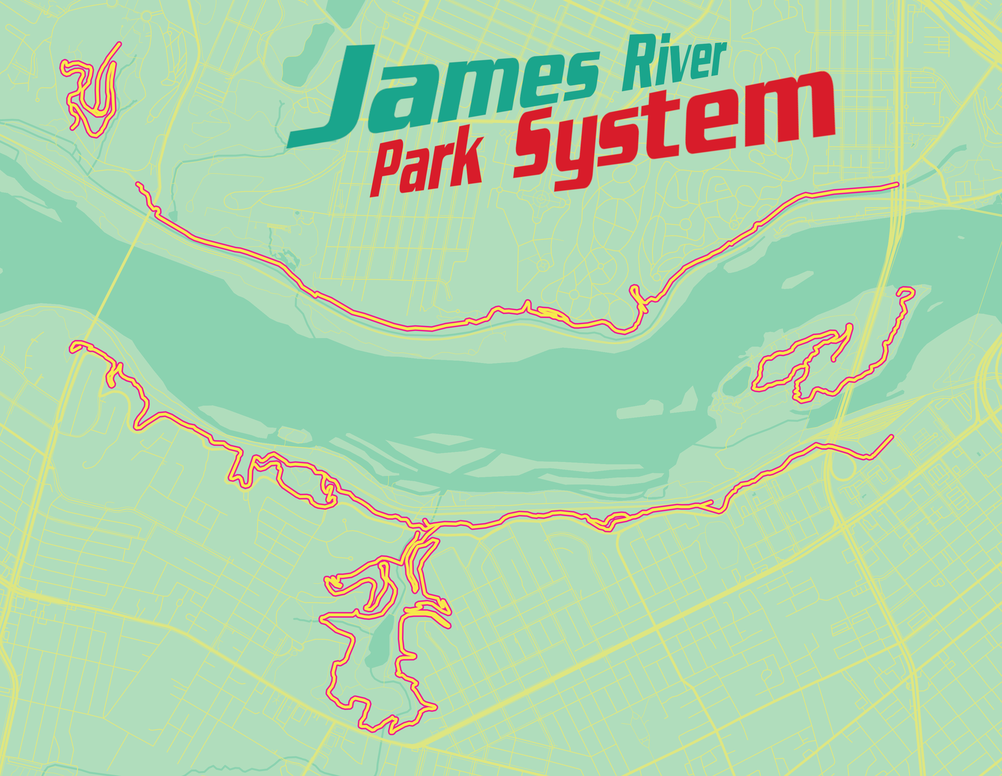